First place for Surveying and Geomatics team at the National Society of Professional Surveyors 24th Annual Student Competition
Congratulations to Clark College’s Surveying and Geomatics team who earned top honors at a prestigious national competition held over spring break, taking first place at the National Society of Professional Surveyors (NSPS) 24th Annual Student Competition.
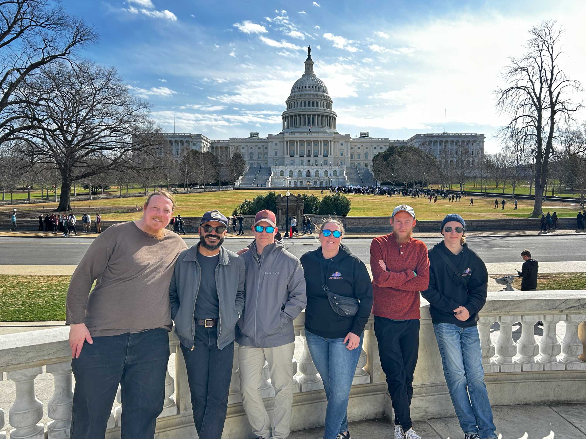
Accompanied by Professor Brian Miyake, six Clark students traveled to Silver Spring, Maryland, and Washington, D.C., to compete against 25 academic teams from across the country. Clark College was the only school representing Washington or Oregon—and the competition marked the college’s first-ever entry into the event.
Clark’s first-place Surveying & Geomatics team:
- Robert Clapham, Class of 2026
- Eli Deschand, Class of 2025
- Rebecca Dunphy, Class of 2025
- Trevor Geivett, Class of 2025
- Brian Hankins, Class of 2026
- Milad Sadegi, Class of 2026
Clark’s team received support to attend the competition from the following:
- Land Surveyors Association of Washington
- Minister & Glaeser Surveying. Inc.
- PBS Engineering and Environmental
- Professional Land Surveyors of Oregon
- S & F Land Services
- Westlake Consultants, Inc.
“I am so proud of our Clark College students and their outstanding performance in this national competition. Most of the students had never visited D.C. before, so it was a completely new place for them to practice their surveying skills amongst so many historical sites,” Professor Miyake said. “The team showed exemplary professionalism, teamwork and survey ability in timed events and in the local D.C. community, while representing our state and college with pride and confidence.”
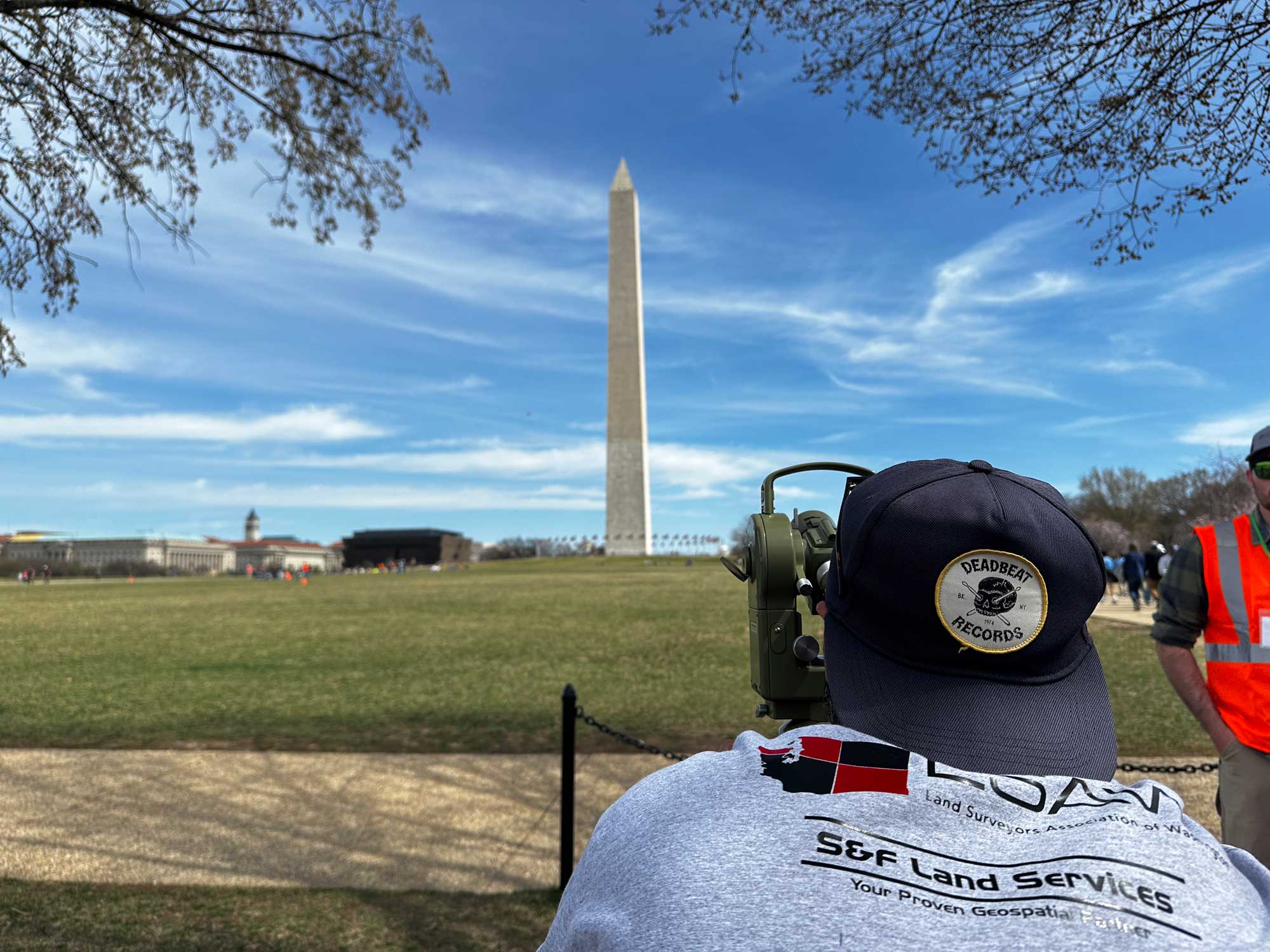
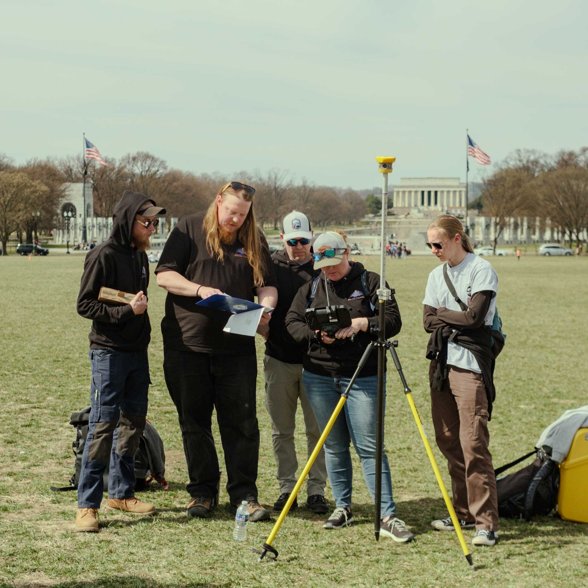
The competition consisted of one day of monument scavenger hunt and one day of technical field exercises–with students utilizing historical and modern survey instruments to complete tasks. A course was laid out on Capitol Mall between the Washington Monument and the World War II Memorial.
Day 1: Monument Hunt. The first portion of the competition was a staged scavenger hunt.
- A list of D.C.-area monuments were assigned a point value and provided the day before the event.
- Monuments farther away or more logistically challenging were assigned higher values due to the risk of finding fewer of them.
- Monuments selected are older and are significant to the history of surveying in the area.
- Teams were released from the hotel in 30-minute increments and had six hours to complete their task. Teams were provided Metro public transit cards. No other mode of transportation was allowed. Teams had to stay together.
- Scoring: Teams accumulated points based on the point values of the monuments visited.
- Teams proved they reached the monument by taking a photo with a timestamp or a group photo in front of the monument. Extra points were provided for social media posts with those photos using #NSPS and #YSN.
Day 2: Measurement Exercises. The second portion of the competition was a four-part timed exercise to evaluate students’ technical ability while requiring some knowledge of historical concepts. Transportation and equipment were provided.
- Route layout: Students were asked to layout a route using a baseline and plans provided using a Trimble Robotic Total Station. Performance was graded on the accuracy of calculated points versus plan and amount completed in time allotted.
- Traverse: Students were asked to perform a four-sided traverse with a chain and compass. Performance was graded on the following criteria: closure, accuracy of leg distances and accuracy of internal angles.
- Triangulation: Students were asked to complete a triangulate exercise of an unknown position from two to three known positions with a theodolite. Performance was graded based solely on the accuracy of the missing variable and calculating the area between the theodolite stations and the unknown position.
- Boundary reconnaissance: Students were asked to calculate a series of points given any number of information that one might find on a deed/plat and utilize those in locating specific real-world points utilizing a Leica GPS unit. Performance was graded on the following criteria: Accuracy of calculated points vs plan and amount completed in time allotted.
About Surveying and Geomatics
Surveying and Geomatics involves the accurate assessment, measuring, and plotting of land and water boundaries for development projects that include buildings, roads, and bridges. Clark’s program uses state-of-the-art land surveying equipment and techniques to prepare students for entry-level work in government and private sector roles.
Learn more
- Surveying and Geomatics at Clark College
- National Society of Professional Surveyors 24th Annual Student Competition


